The best multi-day hiking routes around the world
From the Himalayas in the east to the Appalachians in the west, these are the best classic treks in the world
Through-hiking, multi-day treks, classic hiking – call them what you will, but walking from point A to point B in one continuous line over multiple days while carrying all that you need on your back is one hell of a way to live out an adventure. And this is exactly what we are concerning ourselves with here.
Spanning the globe, from the Himalayas in Asia to the Appalachians in the US, we have curated eight of the best classic multi-day hiking routes that every adventure traveller needs to complete at least one of in their lifetime. These vary in length and landscape, with some involving multiple mountain passes and others being relatively flat. Some require a tent to camp along the way, and others can be managed staying entirely in guest houses and mountain refuges. But what all share in common is their natural beauty and uncompromised connection they offer to the country they pass through. Without further ado, here are the best multi-day treks in the world.
Asia
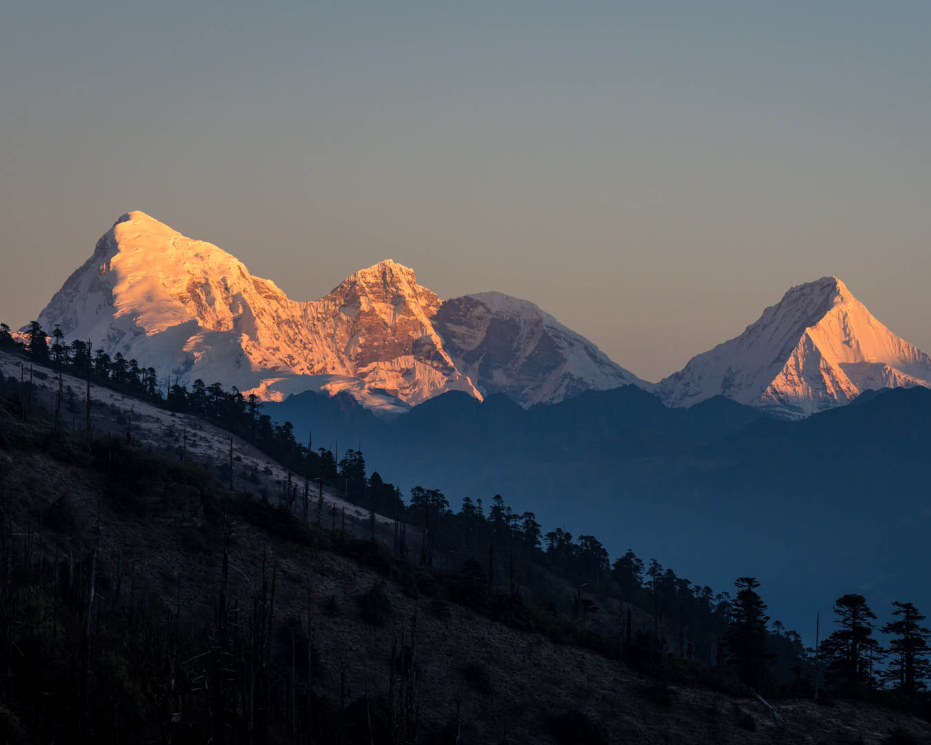
Annapurna Circuit
Where: Himalayas, Nepal
Length: 15-20 days / 160-230 km
Best time to go: Oct-Nov or Apr-May
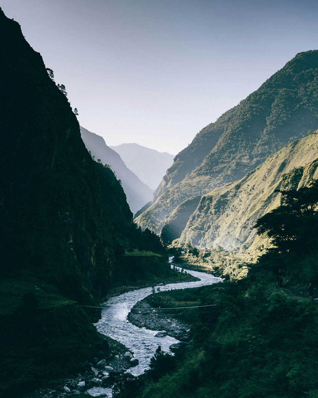
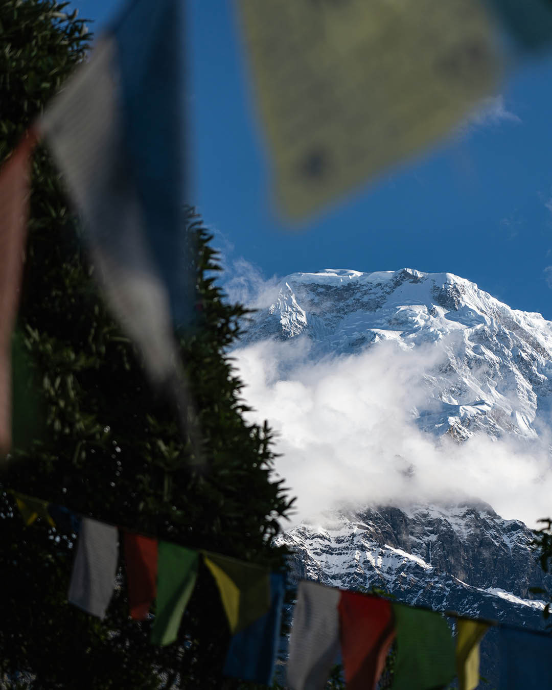
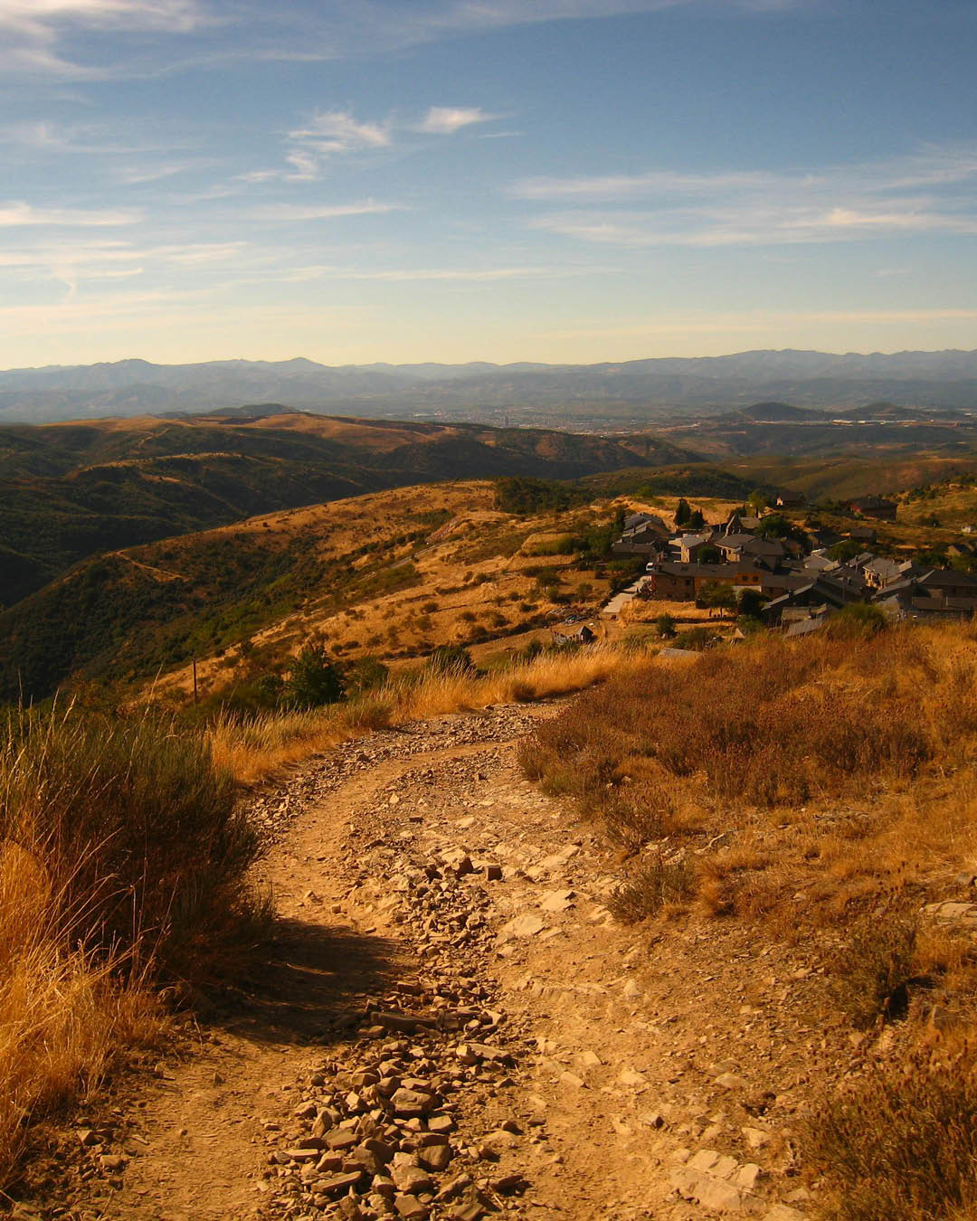
When choosing a location for a truly epic hike, you can’t beat the tallest mountain range in the world, which is exactly where one of the best multi-day treks can be taken. The Annapurna Circuit is a classic hiking itinerary that loops the Annapurna Massif in Nepal. The route varies in length but typically takes around 15 days to complete, taking in two river valleys and multiple mountain passes. The highest point of the trip is the Thorung La pass, ascending more than 5,416 metres in elevation – so acclimatisation is definitely a consideration for this trip. The typical starting point for the trek is at Besisahar in the Marshyangdi river valley, which is accessible via a seven-hour drive from Kathmandu, and hikers usually stay in a combination of mountain refuges and guest houses during the trek. Encompassing a variety of climates and elevations, from subtropical forests and rice paddies to far-reaching views of 8,000m peaks, there’s a reason the Annapurna Circuit is often considered the best long-distance trek in the world.
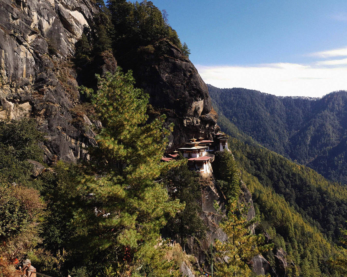
Trans Bhutan Trail
Where: Bhutan
Length: 7-36 days / 403 km
Best time to go: Sep-Dec and Mar-May
A newer addition to the classic long-distance trek circuit is the Trans Bhutan Trail, which was inaugurated in 2022. The trail is a restored ancient pilgrimage route that covers the length of the country. Until the 1960s, when roads were first constructed in Bhutan, this was the only way to cross the valleys and villages of the country, and it remains the finest way to experience this remote Himalayan kingdom. The trail is a non-profit initiative and all proceeds from your visit go back into supporting the trail and the communities you visit along the way. The total number of annual visitors to Bhutan is limited and a 200 USD-a-day minimum trip price must be observed, which goes towards your guide (also mandatory) and your accommodation (which usually consists of a combination of guest houses, hotels and campsites for the trek). Hiking the full route will take around a month to complete, so many visitors opt for tackling a portion for a week or two instead. Expect classic Himalayan scenery with distinctive Bhutanese twists, such as fortified dzong settlements, Buddhist temples, stupas and prayer flags flapping in the wind.
Hokkaido East Trail, Japan
Where: Hokkaido, Japan
Length: 14 days / 370 km
Best time to go: Apr-Oct
Japan’s northern island of Hokkaido is well known to skiers for its reliable fresh powder, but the new Hokkaido East Trail, opening in October 2024, is set to position the region as a year-round adventure destination. The new 370km trail will allow visitors to cross three national parks, including the Kushiro Shitsugen National Park (home to Hokkaido’s red-crowned cranes) and Akan-Mashu National Park, home to the Lake Akan Ainu Kotan – one of the key indigenous Ainu settlements on the island. Be among one of the first adventurers to experience Hokkaido via this new route this autumn.
Europe
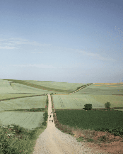
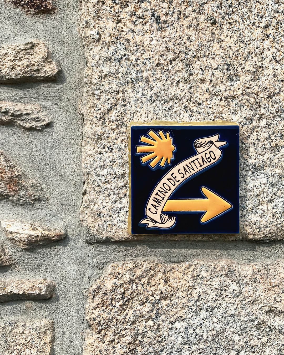
Camino de Santiago, Spain
Where: Spain
Length: 26 days / 780 km
Best time to go: Mar-May or Sep-Oct
Camino de Santiago (the Way of St James) is a vast network of ancient pilgrimage routes that cross the whole of Europe, which coalesce around the tomb of St James (Santiago) in Santiago de Compostela in northwest Spain. The most popular route begins near Biarritz in France before crossing the Pyrenees, traversing the mountains of northern Spain, and arriving in Santiago de Compostela in the west. Unlike the itineraries suggested above, passages of the Camino de Santiago are less mountainous in parts, including the coastal portion of Camino del Norte. However, the main challenge here is completing the entire route in one go, which is no simple undertaking. Many hikers opt instead to tackle it in stages, completing the entire hike over successive trips. There are numerous other tributaries that join the main route, owing to how the route developed over centuries from different pilgrimage origins, allowing you to customise your adventure as you please. The main route becomes busy in mid summer, so opt for the shoulder seasons for cooler temperatures and fewer crowds.
Via Alpina, Switzerland
Where: Alps, Switzerland
Length: 20 days / 390 km
Best time to go: May-Oct
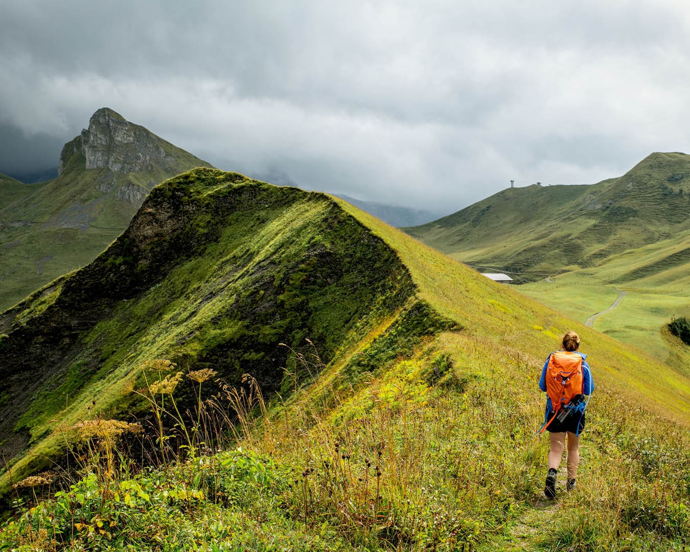
The Alps: the home of mountaineering, skiing and even tourism itself – this mountain range in the centre of Europe holds a special place in mountain lovers’ hearts. If you prefer to leave your crampons at home and wish to cross a succession of mountain passes instead of ascending the peaks, then the Via Alpina is for you. Made up of multiple routes through the Alps, it is possible to link them together to traverse the entirety of the mountain range, from Slovenia in the east to France in the west, but the portion we are suggesting here falls directly in the centre: from Vaduz (the capital of Liechtenstein) in the east, across the whole of Switzerland, and finishing in Montreux on the shores of Lake Geneva in the west. With 14 mountain passes crossed in total, the key to consider here is elevation rather than total kilometres trod. With ever changing views of lush meadows, towering peaks, high glacial lakes and bell-ringing cows, this is the ultimate hiking route for combining adventure with pure alpine charm. Most hikers will bring a small tent with them and combine nights of camping with stays in hütte – mountain refuges that usually offer bunk beds and a warm meal. If you wish to extend this into a truly epic adventure by covering the whole Alps route, leave yourself around three months to tackle the 2,500 km journey.
North America
Appalachian Trail, US
Where: Appalachians, US
Length: 5-7 months / 3,540 km
Best time to go: Mar-Oct
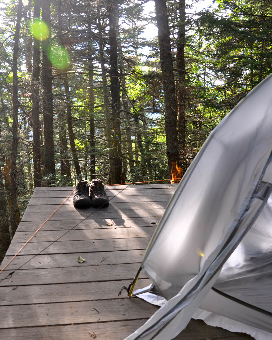
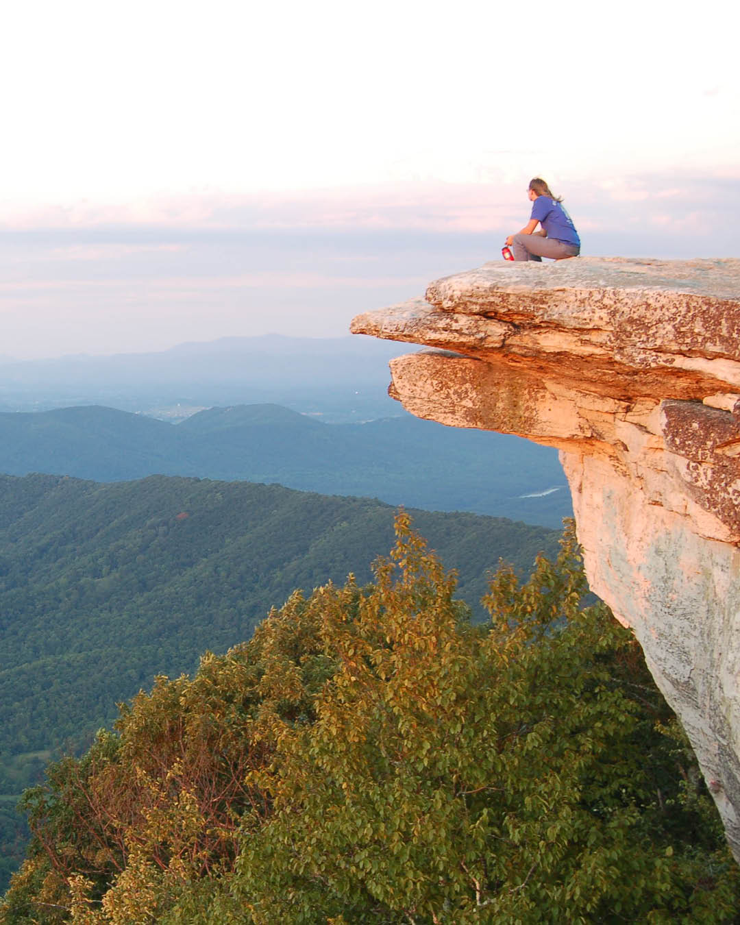
In some ways, the AT is the premiere through-hike in the world. Created in the 1920s and linking 14 states across the Eastern US from Georgia in the south to Maine in the north, the AT follows the entire length of the Appalachian mountain range and covers 3,540 km, making it the longest hiking-only trail in the world. Most of the trail passes through forest and is home to thousands of species of plants and animals, including the American black bear, so make sure you sling your food up in a branch each night before curling up in your sleeping bag. Most through hikers will bring a small tent with them, and there are 250 shelters along the whole route, where three-walled structures with a privy and a water source nearby offer a point to aim for each day. Around three million people complete a portion of the route each year, and around 3,000 or so attempt the full distance – there are even some that turn back at the end and complete the route again in reverse for a ‘yo-yo’ adventure.
North Africa
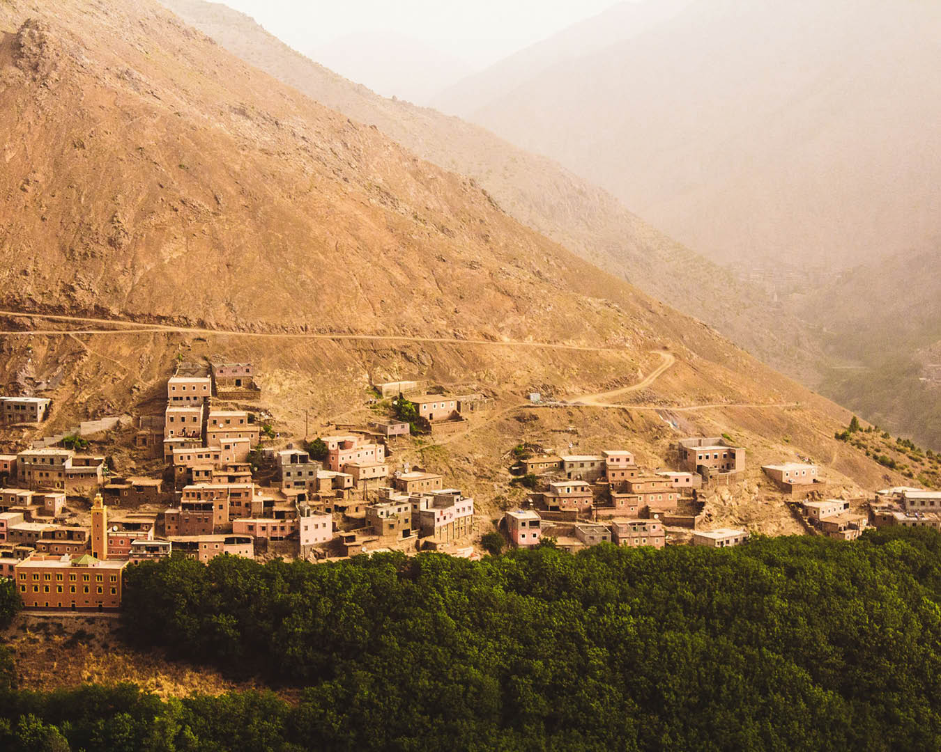
Toubkal Circuit
Where: Atlas Mountains, Morocco
Length: 3-6 days / 60 km
Best time to go: Mar-Oct
As a shorter route than others on this list, this adventure in the Atlas Mountains makes for a good first hiking trip if you are still gathering experience. With an excellent network of guides, who are often accompanied by a muleteer and mule to carry food and water, a trip around the Atlas Mountains is straightforward. Toubkal is the highest peak in North Africa, and this itinerary involves an ascent of the mountain as well as a loop of the multiple valleys and villages that surround it, while staying in mountain refuges and village guest houses along the way. The best place to begin the trip is the mountain village of Imlil, which is easily accessible via a one-to-two hour drive from Marrakech, and is where several guide companies operate from.
Oceania
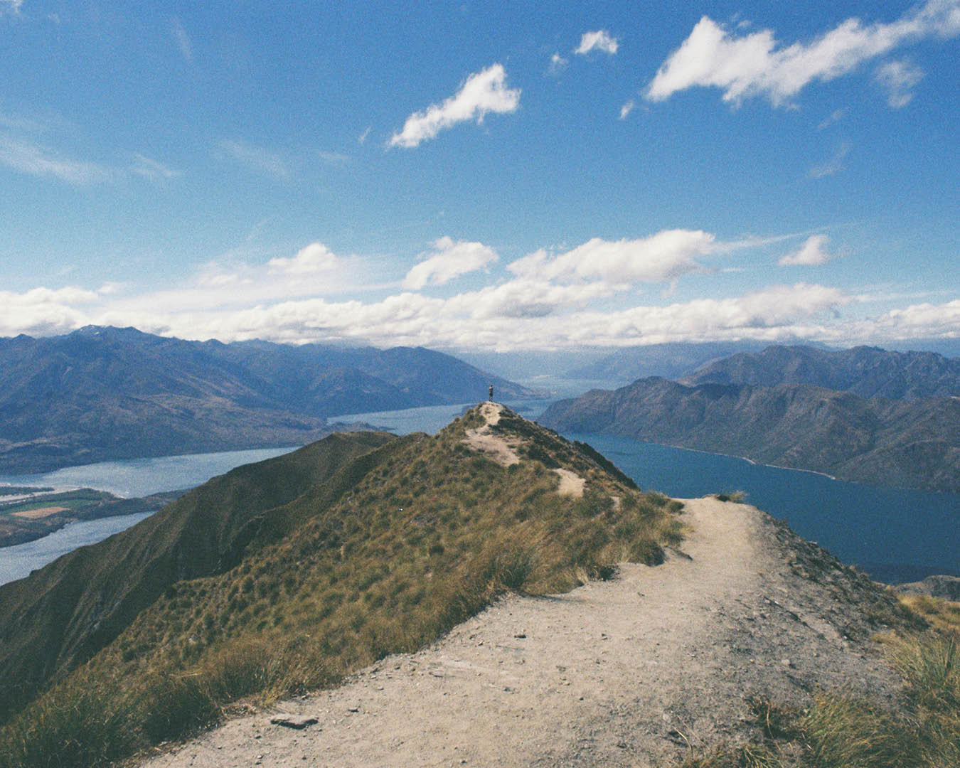
Te Araroa
Where: New Zealand
Length: 3-6 months / 3,000 km
Best time to go: Sep-Apr
Te Araroa, meaning The Long Path, crosses the length of New Zealand’s two main islands over a 3,000 km route from Cape Reinga on the north coast to Bluff on the south. The trail is a mix of wilderness tracks, paths through paddocks, roads, beaches, and a river section that must be kayaked, and takes in volcanoes, mountains, lakes and valleys. Another notable section is a nine-day stretch in the South Island with no resupply points, so hikers must plan ahead and pack enough supplies to cross. Most hikers take three to six months to complete the whole thing, or they divide it up into sections and complete it one week at a time, staying in guest houses in the towns you pass along the way, and camping out in the backcountry in between.